Soon shall all the songless wood
Shiver in the deepening snow…
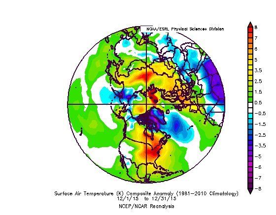
Instead, December 2015 unveiled an entirely different scenario. Large parts of North America, Europe, and Asia basked in unseasonable warmth.
In North America, as wave after wave of warmth washed over the Continent, the “deepening snow” did not come and the “songless wood” did not “shiver.” Rather, the verse of Alice Lord’s “Indian Summer’s Aftermath” much better described what happened in the New York City area:
O dreamy days that linger
With trace of summer yet!
So soft, so mild, so mellow…
O peaceful days and golden!
Ye call back summer flowers…
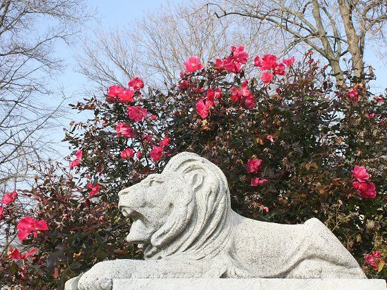
Larchmont, New York
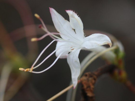
The New York Botanical Garden (Bronx, New York)
The result was a record-breaking December for the New York City area.

Day after day of the finest temperatures of spring or autumn, depending on one’s preference, saw this year smash the existing record for warmest December by 6.7°F (3.7°C). The second largest difference between the most extreme monthly average temperature and second most extreme monthly figure is 2.8°F (1.6°C).

Statistically, December’s average temperature of 50.8°F (10.4°C) was 3.075σ above the normal average, making it a once-in-950-year event.
Numerous daily record high minimum and maximum temperature records were set or tied.
Record High Maximum Temperatures:
December 13: 67°F/19.4°C (broke record of 64°F/17.8°C, 1923)
December 14: 67°F/19.4°C (tied record of 67°F/19.4°C, 1881)
December 15: 68°F/20.0°C (broke record of 67°F/19.4°C, 2008)
December 24: 72°F/22.2°C (broke record of 63°/17.2°C, 1996)
December 25: 66°F/18.9°C (broke record of 64°/17.8°C, 1982)
Record High Minimum Temperatures:
December 11: 50°F/10.0°C (broke record of 48°F/8.9°C, 1971)
December 12: 55°F/12.8°C (broke record of 53°F/11.7°C, 1899)
December 13: 55°F/12.8°C (broke record of 51°F/10.6°C, 1991)
December 14: 53°F/11.7°C (tied record of 53°F/11.7°C, 2001)
December 15: 53°F/11.7°C (broke record of 48°F/8.9°C, 2001)
December 17: 50°F/10.0°C (broke record of 48°F/8.9°C, 1984)
December 24: 63°F/17.2°C (broke record of 50°F/10.0°C, 1931)
December 25: 57°F/13.9°C (broke record of 50°F/10.0°C, 1979)
The low temperature of December 24 tied the previous record high temperature for the date. It set a new monthly record for the warmest minimum temperature recorded in December. It is the highest minimum temperature registered in the November 10-March 27 timeframe.
In addition, for the first time on record, which goes back to 1869, December had no days on which the temperature fell to 32°F (0.0°C) or below. The previous fewest days on record for December was 6 days. That record was set in 1984 and tied in 2006. There are only 10 cases in November that had 0 days on which the temperature fell to freezing. Moreover, the 11 days on which the minimum temperature stayed at or above 50°F (10.0°C) smashed the record of 5 days set in 1982 and tied in 1998. It also matched the November record for most such days.
December 2015 was so warm that it would have ranked just above November 1999 as the 9th warmest November on record. Even more remarkable, it was warmer than Octobers 1876, 1888, 1889, and 1925.
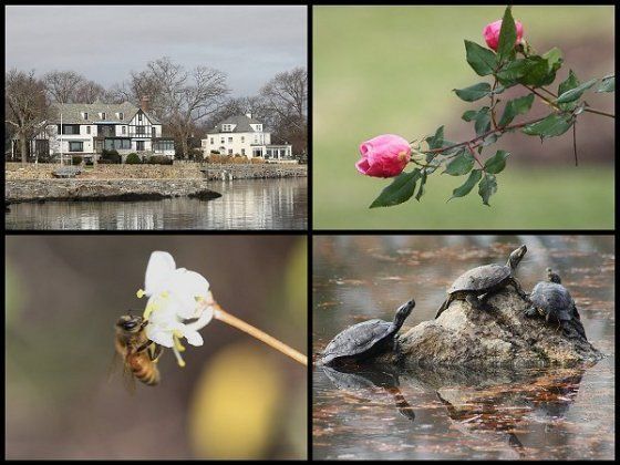
Christmas 2015 scenes (Clockwise from the top left: Larchmont, New York; Larchmont, New York; New Rochelle, New York; and, Mamaroneck, New York)
As one looks ahead, there are growing indications that Old Man Winter will awaken in January. Winter’s return will come too late to salvage December and the shattered dreams of a white Christmas and joyful sleigh-riding that melted away in its exceptional warmth. Even when winter finally arrives, memories will long linger of the truly remarkable December of 2015.
In the meantime, as December came to a close, a range of flowers remained in blossom and some bulbs had even sprouted.
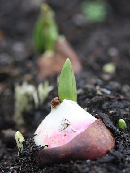
Larchmont, New York
Finally, for those who may have some interest, a short note on climate change follows. Although attribution science is still in its infancy, at least one paper draws upon a mechanism that suggests that ongoing climate change may have contributed to the extreme December outcome. Dr. Jennifer A. Francis of Rutgers University’s Institute of Marine and Coastal Sciences and Dr. Stephen J. Vavrus of the University of Wisconsin-Madison’s Center for Climatic Research found that “enhanced warming in the high northern latitudes” had led to “weakened zonal winds” and “increased wave amplitude.” Those effects are most evident in autumn and winter and are tied with Arctic sea-ice loss. Those factors lead to a slower progression of “upper-level waves” leading “weather patterns in the mid-latitudes to be more persistent, which may lead to an increased probability of extreme weather events that result from prolonged conditions, such as drought, flooding, cold spells, and heat waves."
Earlier this year, February saw a situation similar to this past December during which a prolonged period of exceptional cold led to that month’s having a temperature anomaly of 11.4°F/6.3°C below normal. As a result, water bodies, including the Long Island Sound, froze up to a rare extent.
15 comments
William Sutherland said:
RHH said:
Pam J said:
I collate weather info for CoCoRaHS... which isn turn is used by NOAA and many many other major organisations.
Its fascinating and simply amazing. Its amateur observations and precice recording with set instruments from Canada to the Mexico border and Hawaii and PR to the eastern seaboard and all points in between .
Just a littel note sent out today had atmospheric river info ....
.... California and Arizona -- It's your turn -- Lots of Rain!
All summer and fall, the strengthening El Nino (much warmer than average sea surface temperatures along the Equator in the Pacific Ocean west of South American) has captured the attention of meteorologist and the media. Forecasters have warned that January and February could get "very interesting" in the Southwest U.S. Up until now, the heaviest rains on the West Coast have all taken aim on Washington and Oregon. But now it's January and, right on cue, the jet stream is dipping southward. CA and AZ are in for a few days of rain -- possibly heavy. The future beyond this week is less certain, but what we used to call "The Pineapple Express" may come back strong in mid January. Will the "Atmospheric Rivers" be flowing? Stay tuned and get ready. "....."
And... for those not believing in Climate Change.... those who didnt want to hear what we screamed out loud 40 years ago.... and warned had to be dealt with then ..... Welcome to the near Normal !
Thankyou again Don... as ever a beautifully written article.
Don Sutherland replied to Pam J:
Unfortunately, as often happens, there will probably be mudslides in parts of that state. Still, all in all, the benefits of easing or breaking the drought will vastly outweigh the negative impacts of the rainfall.
Stormlizard said:
.
I moved here in 1966. my first winter was a record cold one, Øresund and Kattegat straits were both frozen as were all other narrow seaways around Denmark, our Icebreakers worked overtime. Seven years later we had another period of very cold very long winters, and again in the mid eighties with what we call "Screw ice" forced up the cliffs and over coastal roads. Temperature on 14th January 1986 at mid day with clear sky no wind was minus 26C, we had no Spring as such but suddenly one of the hottest summers on record and no rain at all until October. Similar cycles have persisted but with fewer extreme winters.
During these years Denmark has recorded an increase in major storms and Hurricanes, an increase not only in the severity of the storms but the frequency of them too.
Don Sutherland replied to Stormlizard:
Stormlizard replied to :
Don Sutherland replied to :
Stormlizard replied to :
Last year our first snow was in November but it quickly melted, December was wet and for the most part remained at 10 C, none as yet this year but it is very cold now, just checked down to minus 6.5 C
Don Sutherland replied to :
Malik Raoulda said:
Don Sutherland replied to Malik Raoulda:
tiabunna said:
Richard Nuttall said:
Esther said: